A 360-Degree View of Natural Beauty in the Netherlands<br><h6>Paul Oostveen's project of capturing 360-degree panoramas from natural parks and reserves in all 12 provinces of The Netherlands attracted national attention.</H6>
Feb 18, 2026
The Amerongse Berg forest in Utrechtse Heuvelrug national park, captured on a cold day at the end of autumn with frost on the ground and mist above the forest. © Amazing Aerial Agency / Paul Oostveen
 By Rebecca Duras
For the past few months, lucky visitors to The Dome movie theater in Den Haag could see the beautiful nature of The Netherlands in a way they’ve never seen before. Paul Oostveen’s 360° panoramas, captured in nature reserves and natural parks in all 12 provinces of the country, highlight the often-overlooked natural beauty of the country.
Paul embarked on this project to highlight nature in The Netherlands, but he’s taken 360° panoramas in Iceland and Ukraine (before the war). Inspired by the unique perspective on a natural area that he could create using these panoramas, he turned his lens to his home country.
During his years-long project, Paul criss-crossed The Netherlands, coordinated with dozens of governing bodies for the right permits, and spent countless hours editing his work. He captured all four seasons, from the flowering heather fields of spring to the snow and frost of a Dutch winter. In some instances, he captured the aftermath of disaster, such as forest fires, a downdraft storm, and drought.
Ahead of his final live show in Den Haag on February 25th, we caught up with Paul to discuss his project, how he went about putting it together, and the new perspective on his home country that he has.
As a drone photographer, you specialize in nature reserves and the countryside. What made you decide to focus on nature reserves in the Netherlands from above for this project?
Let me be honest. When I bought my first drone, back in 2014, I didn’t think that I would use it much in the Netherlands. At that time, I was already a nature photographer and thought that the Netherlands was just too densely populated, with disturbing elements everywhere like roads, straight ditches, villages and power lines. My idea was that I would mainly use my drone abroad, like in the remote landscapes of Iceland.
How wrong were my initial thoughts! I started flying my drone in the Netherlands, in a nature reserve that I had visited and photographed many times on the ground. I was totally surprised when my drone took off! There was so much to see that I never knew was there. The area was so beautiful from above and looked completely different. Nowadays, I prepare my flights very well with location descriptions and satellite views, but the photos and videos I take keep surprising me. It’s so amazing to see Dutch nature reserves from the sky.
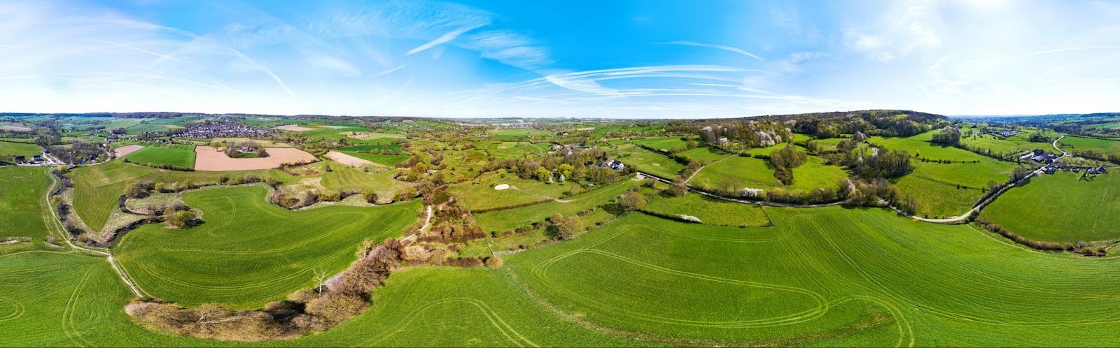
The hills of south Limburg over the meandering river Geul add dynamism to the normally flat landscape of The Netherlands.
How did you come up with the idea for this project? What inspired you to showcase the natural beauty of the Netherlands with 360° panoramas specifically?
An aerial photo is a great way to showcase an area. The high point of view gives a great overview in one image, from a perspective we cannot see from the ground. However, a 360° panorama goes much further. You can look around over an area in all directions at the same time. One panorama can accumulate all the different landscape elements of an area in one beautiful image. It is a fantastic and surprising way to showcase the beauty of our nature reserves.
After I discovered the power of 360° panoramas, I started to photograph nature reserves from all 12 provinces in the Netherlands in 360°. I was looking for diversity, including many different natural landscape types. With this project, I want to share my admiration of Dutch nature as seen from the sky, my aerial journey of discovery through the Netherlands.
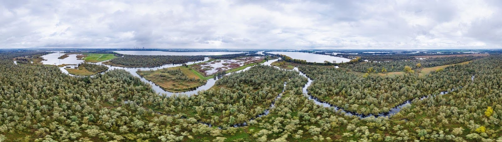
Creeks cut through willow groves in De Biesbosch, the biggest freshwater tidal area in all of Europe.
What was the process of shooting the panoramas like? What equipment did you use to create these panoramas?
The first step was to select the areas I would photograph, distributed across different provinces and natural landscape types. After I selected a new area, like a national park or other nature reserve, I used area descriptions, satellite views and advice from forest rangers. They helped me find the best spot within that area for creating my panoramas, a place where I can combine all characteristic landscape elements of the nature reserve in one view. For instance, if the nature reserve has a forest, open dunes, lakes and a beach along the coast, I am looking for a place in the middle, where I can catch them all together.
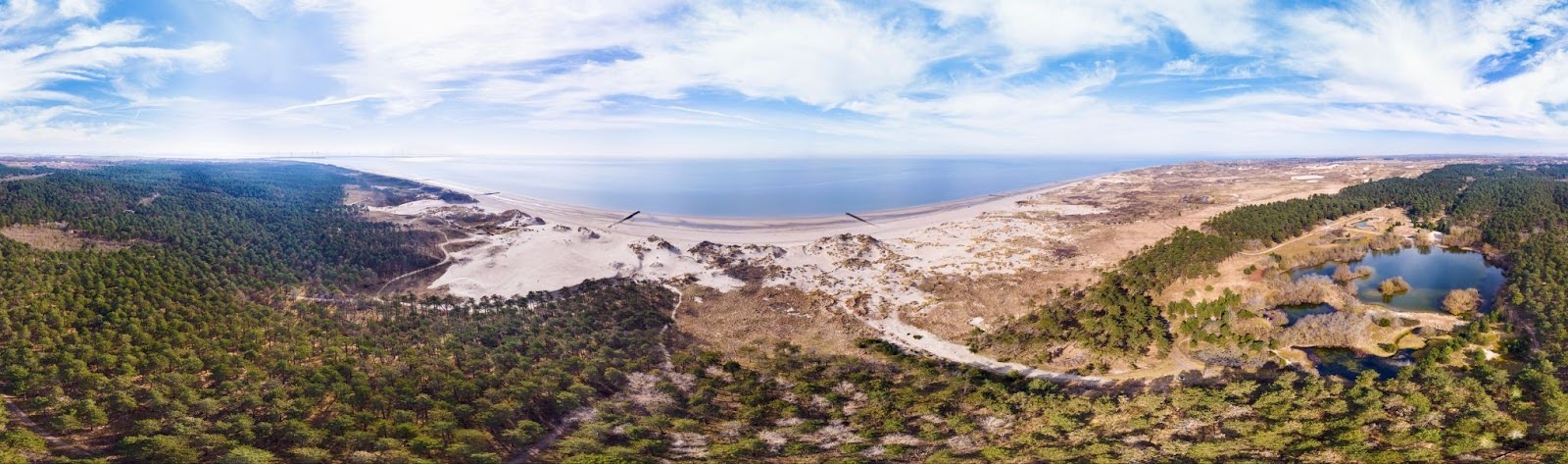
Dunes of Westerschouwen. Paul made sure to include all characteristic elements: the North Sea beach, the forest, a sand drift, open dunes and beautiful lakes.
In most cases, this spot was somewhere in the middle of a nature reserve. Then I asked the forest rangers for permission to fly. I made an operational flight plan with my take-off locations, flying times and risks of the flight. The flight plan includes precautions to minimize risks for people and to prevent disturbance of nature. After I got permission, I waited for a beautiful day (or sometimes the right season). Most of my panoramas are made on sunny days, for brighter colors. The time of the day is also important. I prefer to capture the most interesting part of my panorama away from the sun.
Most of the panoramas were made over the last years with my Mavic 3 and RC Pro, but I also added some older panoramas, created with my former Phantom Pro drones, to my show. After finding the right spot in the air, I turn the drone around for a last check. Can I really catch all interesting elements close enough? What is the optimal height? Are there any annoying distractions, like buildings or reflections of the sun in lakes? Sometimes I need to reposition my drone to avoid them. Then I need to take 40 to 50 photos in all directions, with enough overlap. I need to concentrate, because every photo needs to be well-exposed and sharp.
In most areas, I made photos for a panorama at several spots, to choose the best results afterwards. By the way: while flying I also captured some normal aerial photos and videos of all those beautiful places – also available at Amazing Aerial.
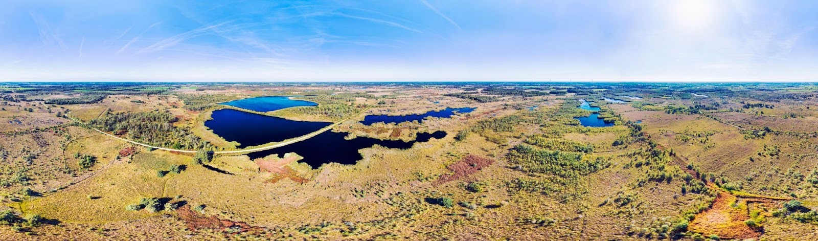
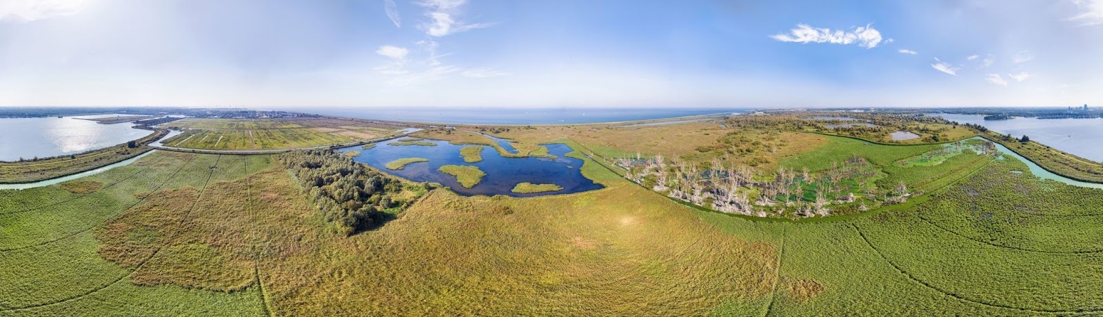
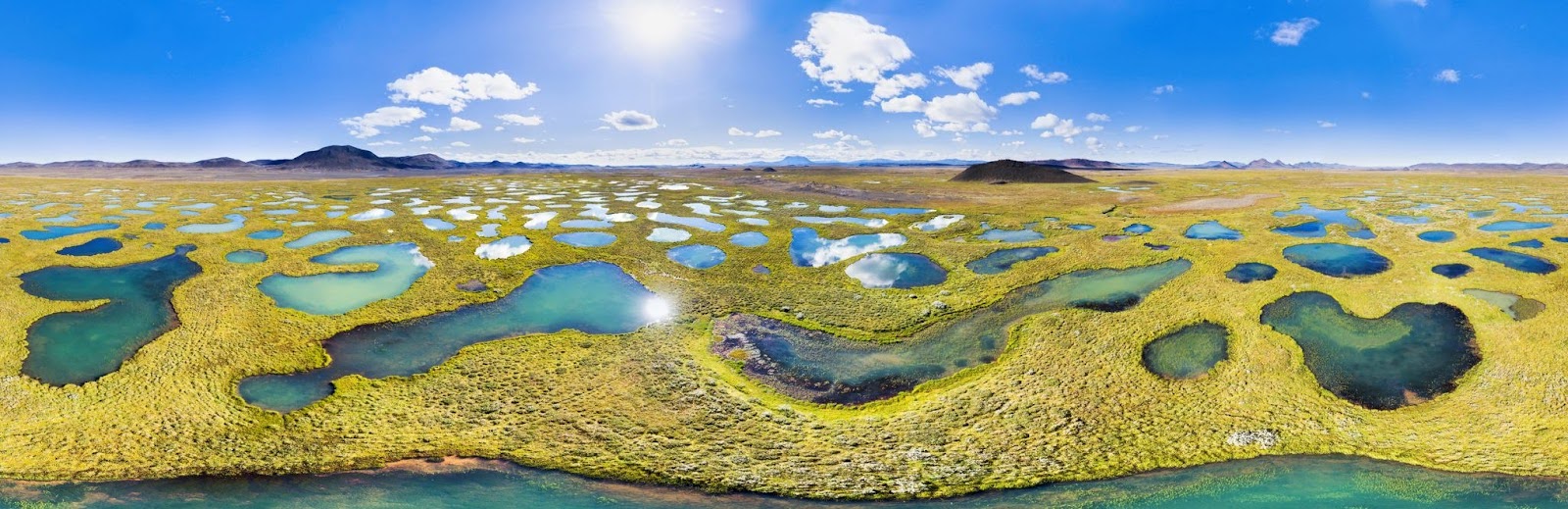
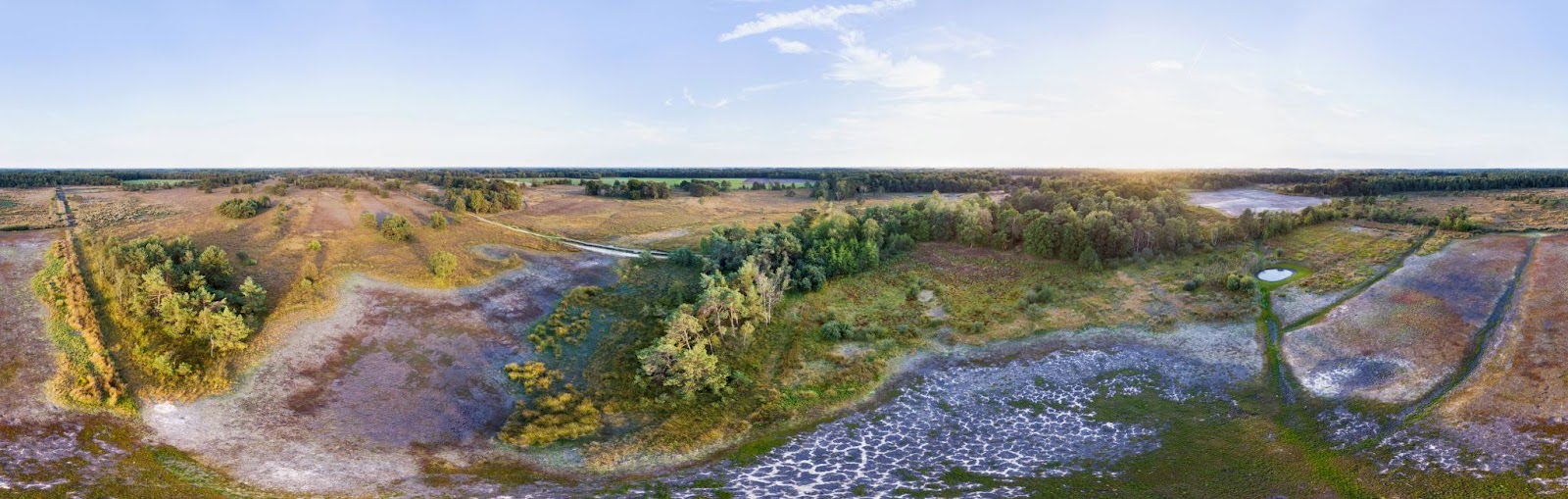
The wetlands of the raised bog area in national park De Groote Peel. It is one of the most bird-rich areas of western Europe.
What is the editing process like in creating the panorama images?
In a 360° panorama, you have to bridge large exposure differences: downward, towards the sun, away from the sun, etc. But I want the result to be evenly exposed in all directions. To achieve this, I carefully developed every single photo (of the set of 40-50), so they matched each other in exposure and color. Only after that, I merged them all together to a full spherical panorama: not only along the full horizon but also straight up and down. Because of the big amount of photos, often some stitching errors occur, especially around the horizon if clouds are moving, or with other moving objects like animals or cars. These errors need to be corrected.
In the full spherical panoramas I created, you can look around in all directions including straight up and down. They can be published on websites or viewing devices, for instance in a visitor centre. These full panoramas are available on request.
However, for paper publications, tv reports or movies, it is often sufficient to look all around along the horizon without looking straight up and straight down. These crops are now available at Amazing Aerial, as you see in the photos shown with this story. All these panoramas are a full 360° wide: the left side connects to the right side. All my 360° panoramas are available in a very high resolution of at least 14,000 pixels wide.
The nature reserve Lepelaarplassen, located in national park Nieuw Land (“new land”) in Flevoland, arose spontaneously after land reclamation in a part of the polder.
Your panoramas were exhibited as a live show in the Dome, the 360° movie theater in Den Haag. How did you come up with the idea to show your photos in this way?
There are several ways to show 360° panoramas. Because of the high resolution, wide view and all the details they are very suitable as spreads in for instance a magazine. In a TV report or video the panoramas can be rotated slowly to give a wide view over an area. I could also decide to publish my panoramas on a website, where visitors can move around and zoom in or out with their mouse.
But to show my panoramas to the general public, I was looking for a place where people really can look all around, in all directions, because that is the strength of 360° panoramas. The Dome (part of Museon-Omniversum) was the perfect place. It is a beautiful movie theatre with an enormous 360° screen, wrapped all around the audience of 300 people. It gives the audience the feeling as if they are floating very calmly over the areas, like in a hot air balloon. With my live shows I could deliver a unique experience, showing our nature reserves in a way never seen before.
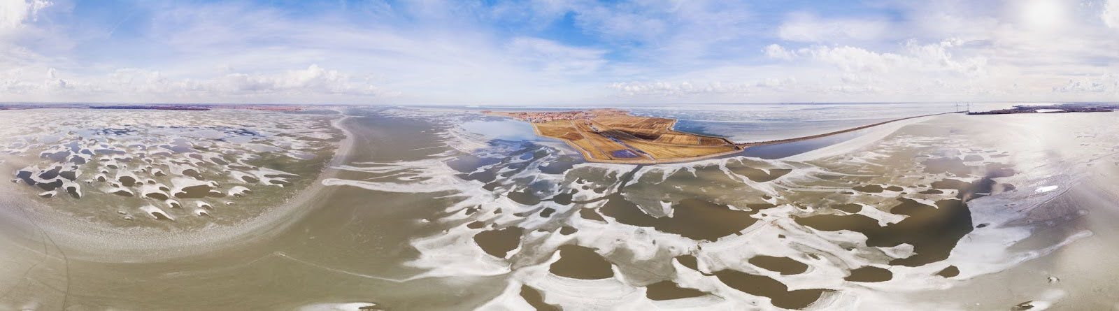
The thaw begins to set in, creating patterns in the ice and frost around the island of Marken
Besides showing the photos, you also talk about your experience creating this project during the live shows. What information do you share with the audience, and what do you want them to learn about Dutch nature from these shows?
That’s right. With every panorama, I tell people about the area and all the different landscape elements that can be seen in my panoramas. How did the nature reserves actually come into being – some of them centuries ago, some recently created in nature development projects? And how do they evolve, for example, under the influence of nitrogen deposition and climate change? What are the effects of wildfires, floods or severe drought on a nature reserve?

I mix it up with my personal experiences. For instance, it was very impressive to walk around in two huge forests that just were burned down one week earlier. We walked there alone, as the areas were still closed to the public for safety reasons. All low vegetation was totally burned away and tree trunks were blackened. But because of the strong winds and speed at which the fire moved, many tree tops were still green. I also noticed that nature is resilient: just one week after the fire, the first green shoots emerged from the ashes.
In another area, I was shocked that all lakes were totally dried out after an extremely dry summer. It was even more impressive from above. In other areas, it was very exhausting to reach my take-off place. Because the most suitable location that I had found was far away from roads and cycling paths, we had to plough a long way through loose sands in high dunes on a very hot summer day.
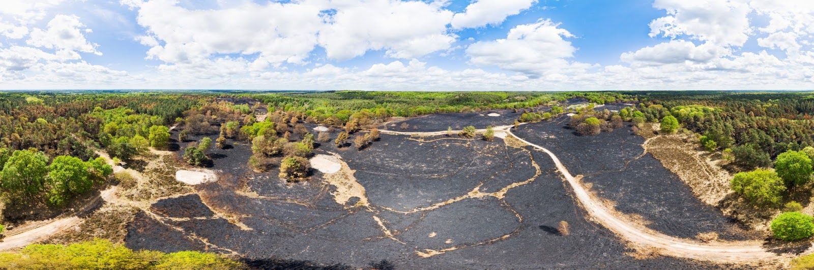
De Meinweg National Park, one week after a forest fire. Although the heather field is completely burned, many tree tops are still green.
What has the response been like, from the audience at previous shows and the wider public?
First of all, this project received a lot of media attention. Several magazines in the Netherlands published extensive stories, each with a few different panoramas as 2-page spreads. Many other magazines and websites published short announcements. Two daily newspapers and two tv stations covered the project with an interview and some of the panoramas. This way, many people could experience the panoramas even without visiting the Dome. But of course, the publicity also contributed to the interest for the live shows. It was a great experience to show my panoramas in a full theatre several times.
After the shows, many visitors came to me to express their appreciation for this experience, for the amazing panoramas, the beauty of the Netherlands and the stories I told. The audience really enjoyed seeing these images on the very large 360° screen, 12 times the size of a normal cinema screen.
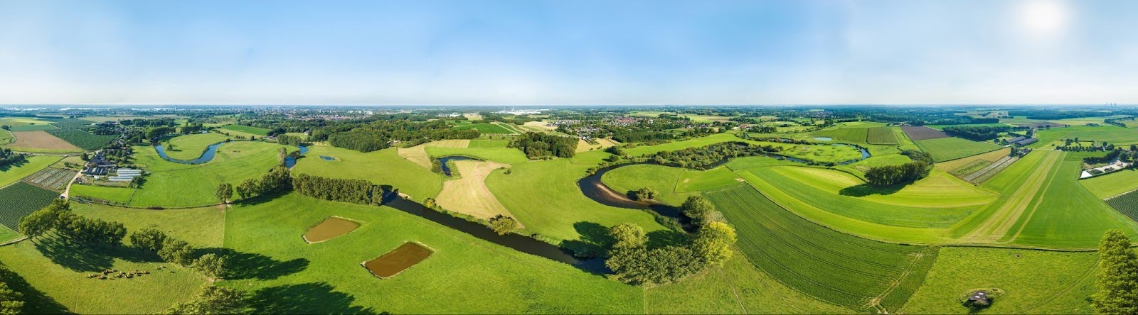
The beautiful curves of the river Roer, between meadows and cropland, are best viewed from above.
What institutional support did you need to complete this project? How supportive were the institutions you had to work with?
First of all, people from the Dome were very cooperative. Their most important requirement was that I had to tell a story with the images—amazing photos would not be enough. I followed a masterclass and a course from two famous nature photographers about storytelling in nature and landscape photography. But while the story developed, The Dome staff helped me with the concept, technical realisation, marketing and ticket sales.

The forest rangers and nature organisations who owned the areas, were also very cooperative. Because this project was so unique, I managed to get permission to fly in many areas where drone permits are difficult to get. Sometimes they gave me advice, additional requirements (like preventing the most sensitive parts of the areas) or even personally guided me through their area. In return, I shared some of my photos and videos with them. After seeing the results, the forest rangers were impressed by the result, especially of course the 360° panoramas.
I was also very happy with the publishers that wanted to share the project in their magazines, as well as some companies that were willing to sponsor this project. Although the whole project cost me a lot of time, I’m very happy with the results and never regretted its realization.
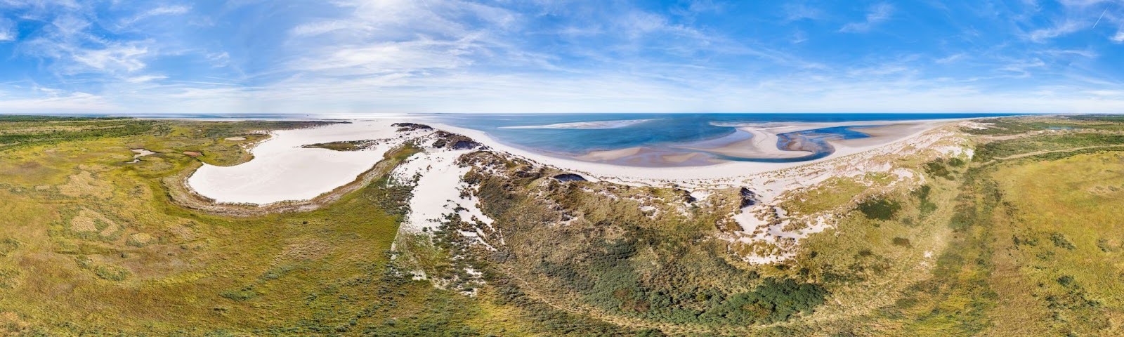
Noordsvaarder is a nature reserve at the edge of Wadden island Terschelling, with dynamic dunes, dune valleys, sand plains and amazing sandbanks along the coast.
There is one last chance to see Paul Oostveen’s live panorama show in Den Haag, on February 25th. Check it out if you’re in the area, but make sure to get your tickets in advance—previous shows have sold out!
See More Stunning Photos Below!
Beautiful lake in the highlands of Iceland, in the Sprengisandur area.
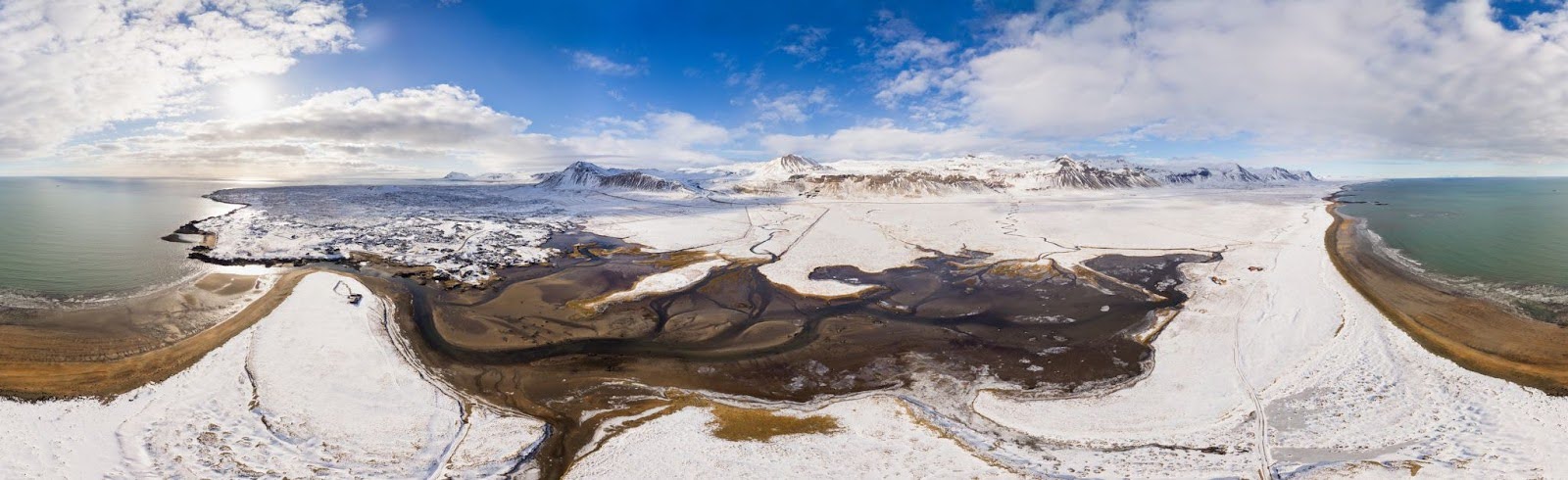
An estuary and beach at Budir on the peninsula of Snaefellsnes in winter, Iceland.
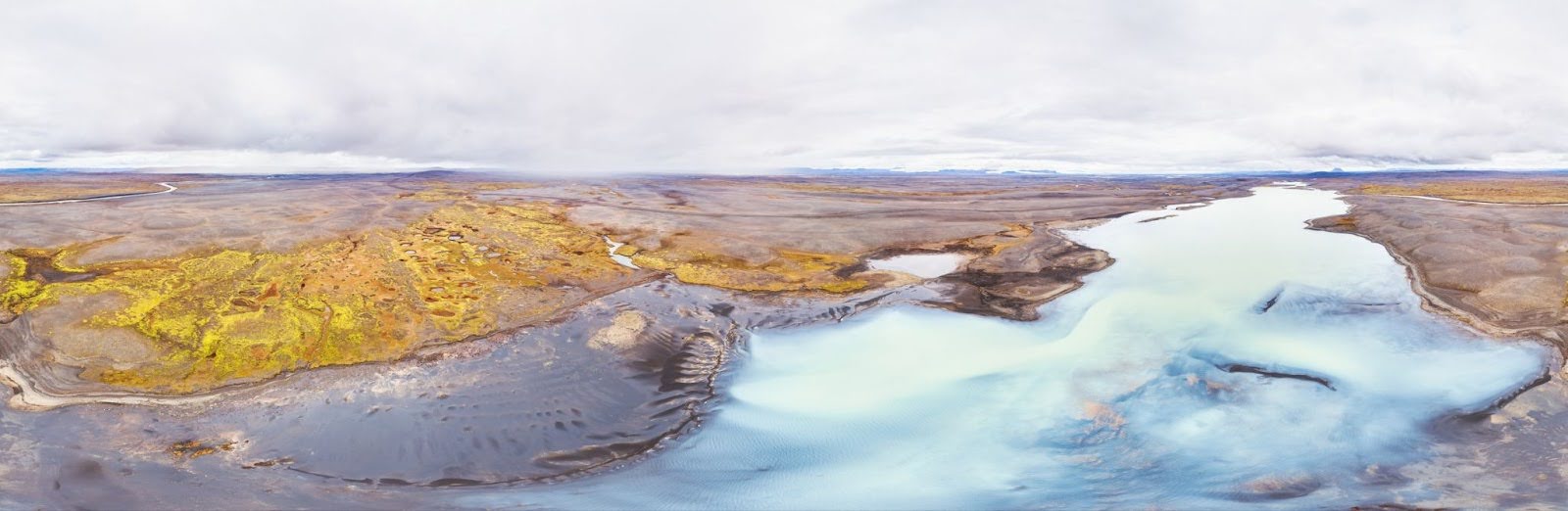
Aerial view of bright turquoise pools in the uninhabited highlands of Iceland, Modrudalsoraefi.
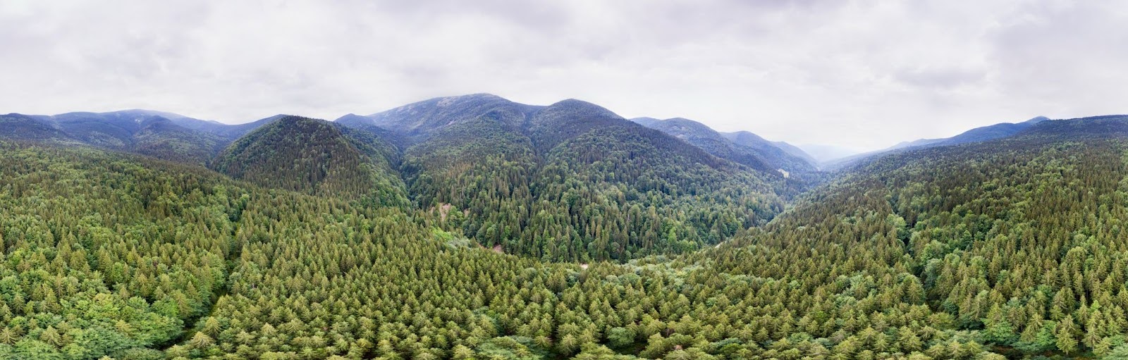
A 360 degree panorama of the forested Carpathian Mountains, Ukraine.
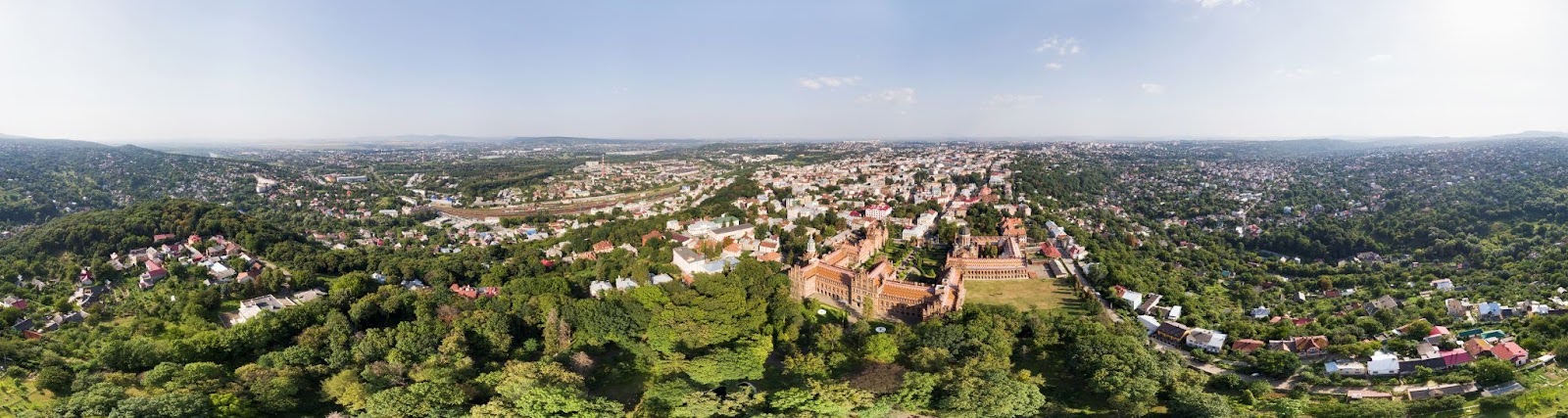
An aerial panorama of the historic city of Chernivtsi, Ukraine.
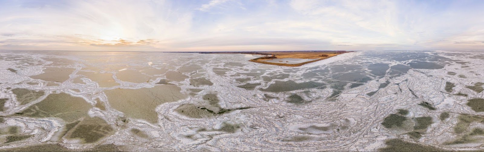
Ice floes and ice shoves float on Lake Markermeer in De Neck nature reserve, Noord-Holland, The Netherlands.
An aerial view of dried out lakes Steenhaarplassen during the drought of summer 2018. During his project, Paul captured the effects of some natural disasters on landscapes across The Netherlands.
Stay updated when we post new articles.
We hate SPAM. We will never sell your information, for any reason.